| Status | Available for Sale (cash or equity) or Joint Venture. |
|---|
Project Overview
Detailed Information
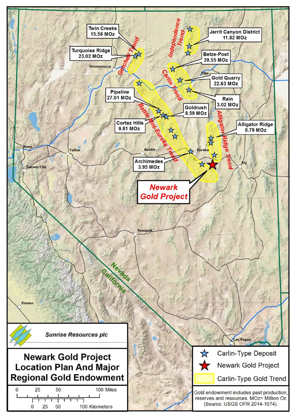
Nevada is the one of the largest gold producing regions in the world with production of nearly 5 million ounces recorded in 2020. Most of this production comes from so-called “Carlin-style” gold deposits where microscopic gold particles occur in silicified, carbonaceous and decalcified silty limestones.
They can be both large (e.g. Goldstrike which contains 39 million ounces gold at a grade of 3.3 g/t) and high-grade (e.g. Barrick’s recent Goldrush discovery which contains 8.6 million ounces gold at a grade of 10.6 g/t).
The majority of known Carlin-style deposits occur in one of a small number of linear belts (“trends”). Favourable factors include chemically receptive limestone host rocks, particularly where folded into anticlines and cut by suitable fault structures. The silicification of the host rocks that accompanies gold mineralisation is often manifest at, or near surface, by so-called jasperoids containing anomalous levels of the elements arsenic, antimony, thallium, barium and mercury.
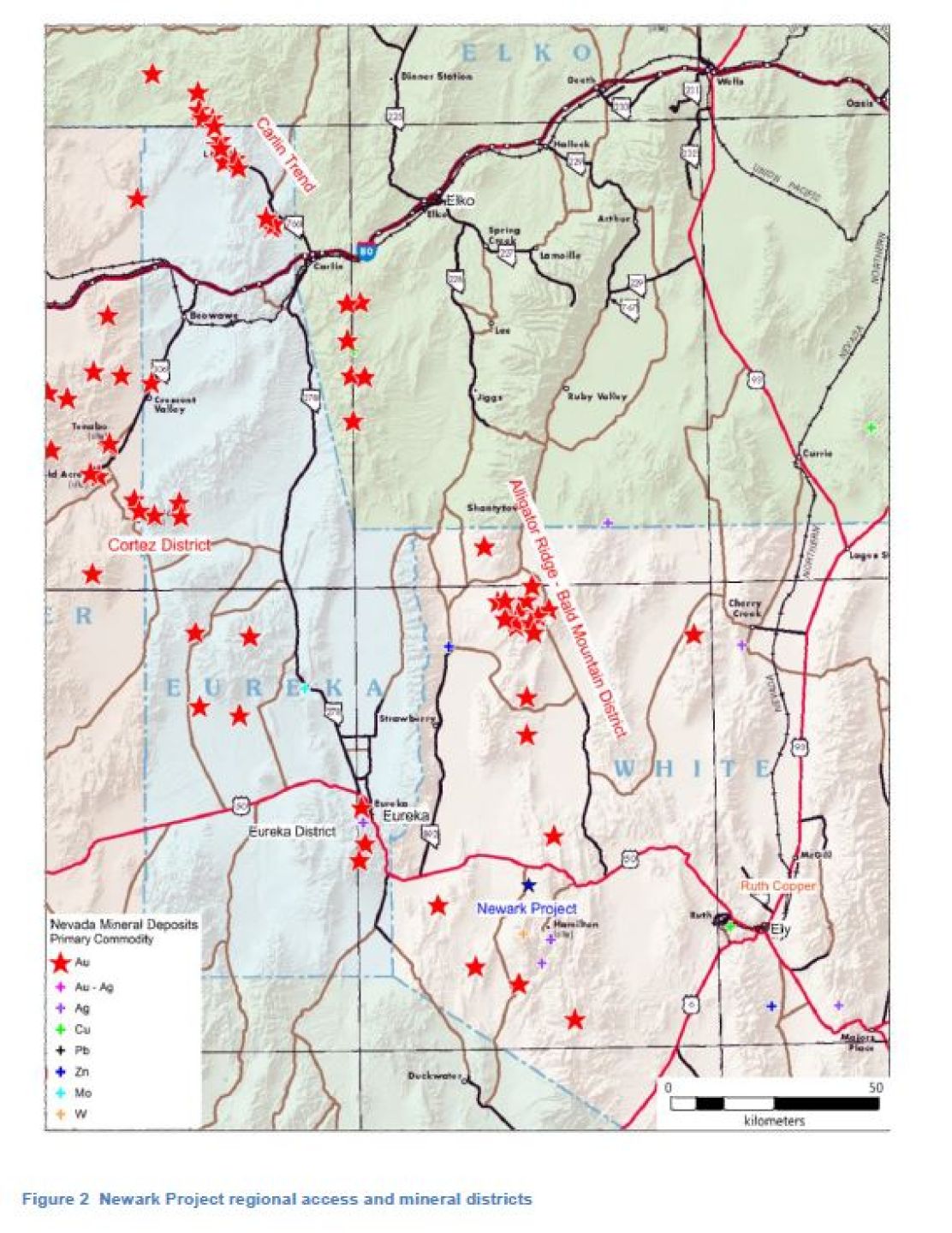
The Newark Gold Project is located at the southern end of the Battle Mountain-Eureka (Cortez) gold trend where intersected by the projection of the Alligator Ridge gold trend. The project is located 72.4 km (45 miles) west of Ely, Nevada in central White Pine County, 40 km south of of the past-producing Alligator Ridge Mine, 12 km north of the Mt. Hamilton Gold Project and 20 km east of the Pan Gold Mine.
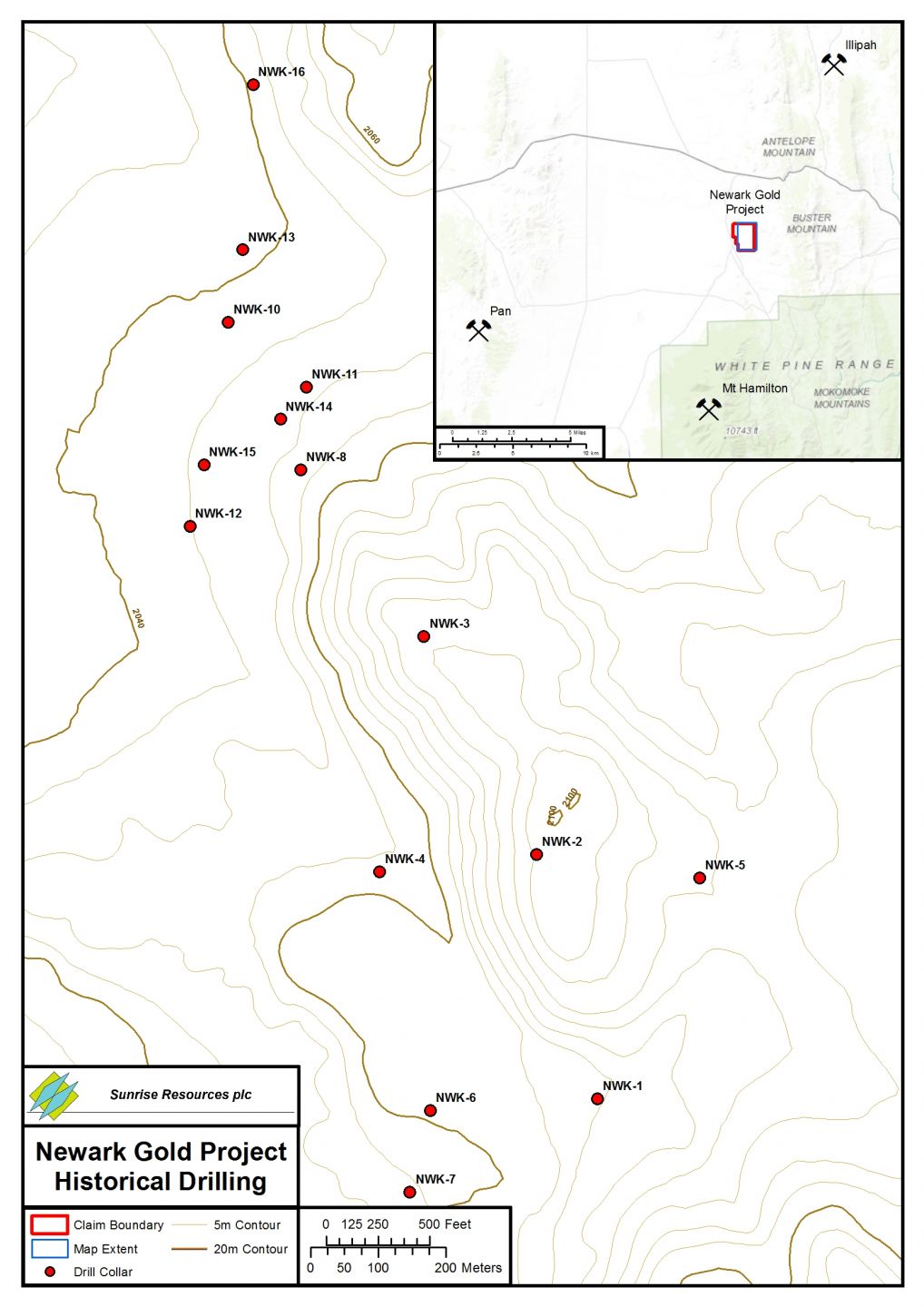
Newark is a former Freeport McMoRan Gold / Freeport Gold Mining Inc. (Freeport) prospect. During their tenure in 1986 and 1987, Freeport conducted geologic mapping, rock chip sampling, a VLF electromagnetic survey, and drilled sixteen reverse circulation holes. Drill logs, assay sheets, chip boards and a geologic map with drill site locations are housed in the Nevada Bureau of Mines and Geology Repository in Reno, Nevada.
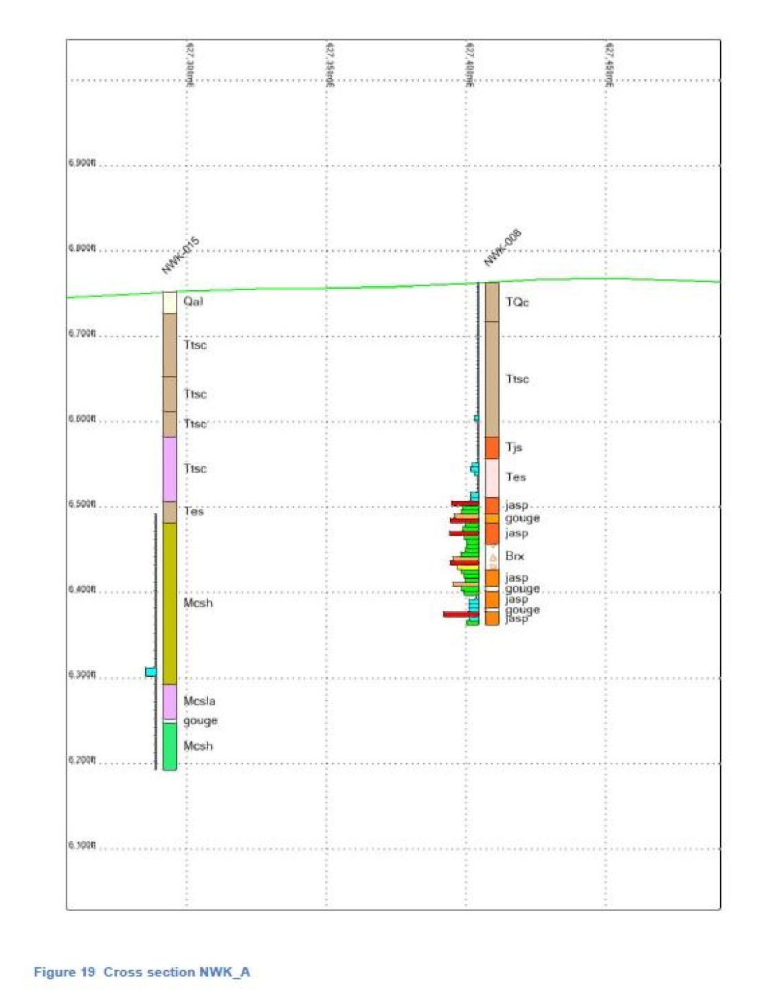
Rock units encountered in the drilling at Newark appear to be (from top to bottom) Tertiary sediments, a brick red conglomerate containing clasts of silicified siltstone of indeterminate age but likely Miocene since it contains pumice tuff, and the Mississippian Chainman Shale. The Chainman is also called a formation in some literature because of variable facies exhibited across its range.
Of the sixteen holes drilled by Freeport, six encountered gold values greater than their detection level of 0.02 ppm in 1986 and 0.002 ppm in 1987. Their best hole was NWK-008 which cut 47m (155 ft) of silicified breccia (jasperoid) that averaged 0.14 ppm Au. This hole ended in mineralisation.
The target is a Carlin-Type sedimentary-hosted disseminated gold deposit formed at the intersection of a regional anticline, deep basin bounding faults, and receptive host rocks within and below the Chainman Shale. Work to date has shown that the major elements of this target type are in place at Newark, along with low grade mineralisation encountered in the Freeport drilling.