| Status | Drill Ready. Available for Sale (cash or equity) or Joint Venture. |
|---|
Project Overview
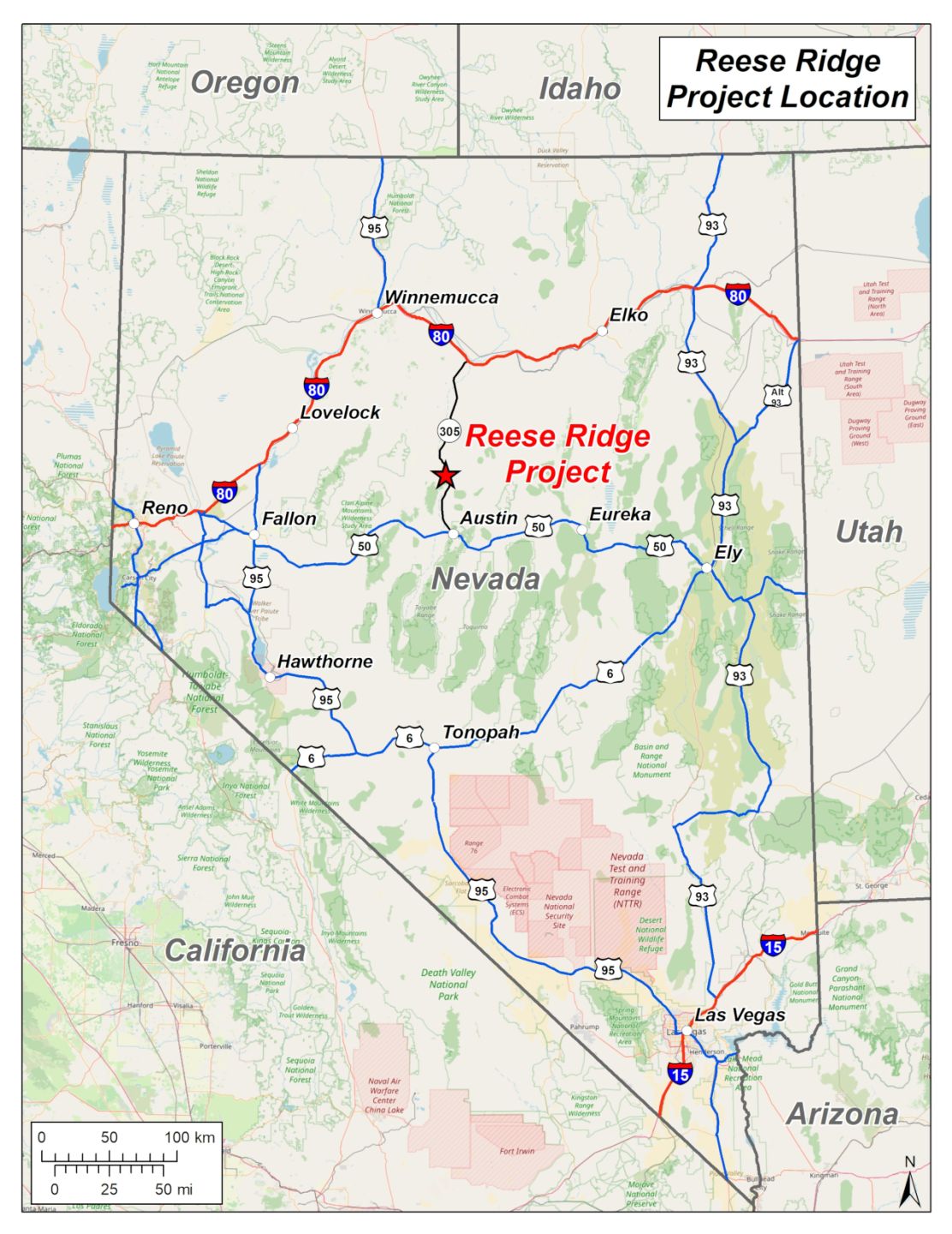
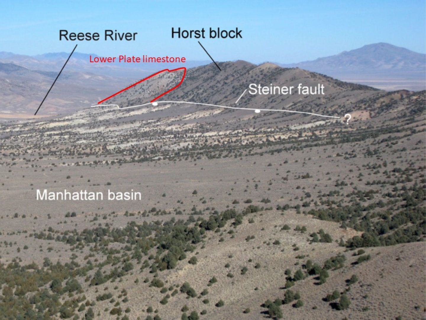
The Reese Ridge Project covers a fault bounded horst block of fault juxtaposed Lower Plate limestones/shales and Upper Plate Antler sequence sediments bounded to the east and west by Tertiary age volcano-sedimentary basins. Mineralisation occurs within Lower Plate limestone.
The Reese Ridge Project was first suggested as an interesting target when prospecting by the Company yielded a sample of unremarkable limestone sample containing a few spots of the lead sulphide mineral galena gave an analytical result of 15.9% zinc (alongside 0.3% lead and 17ppm silver).
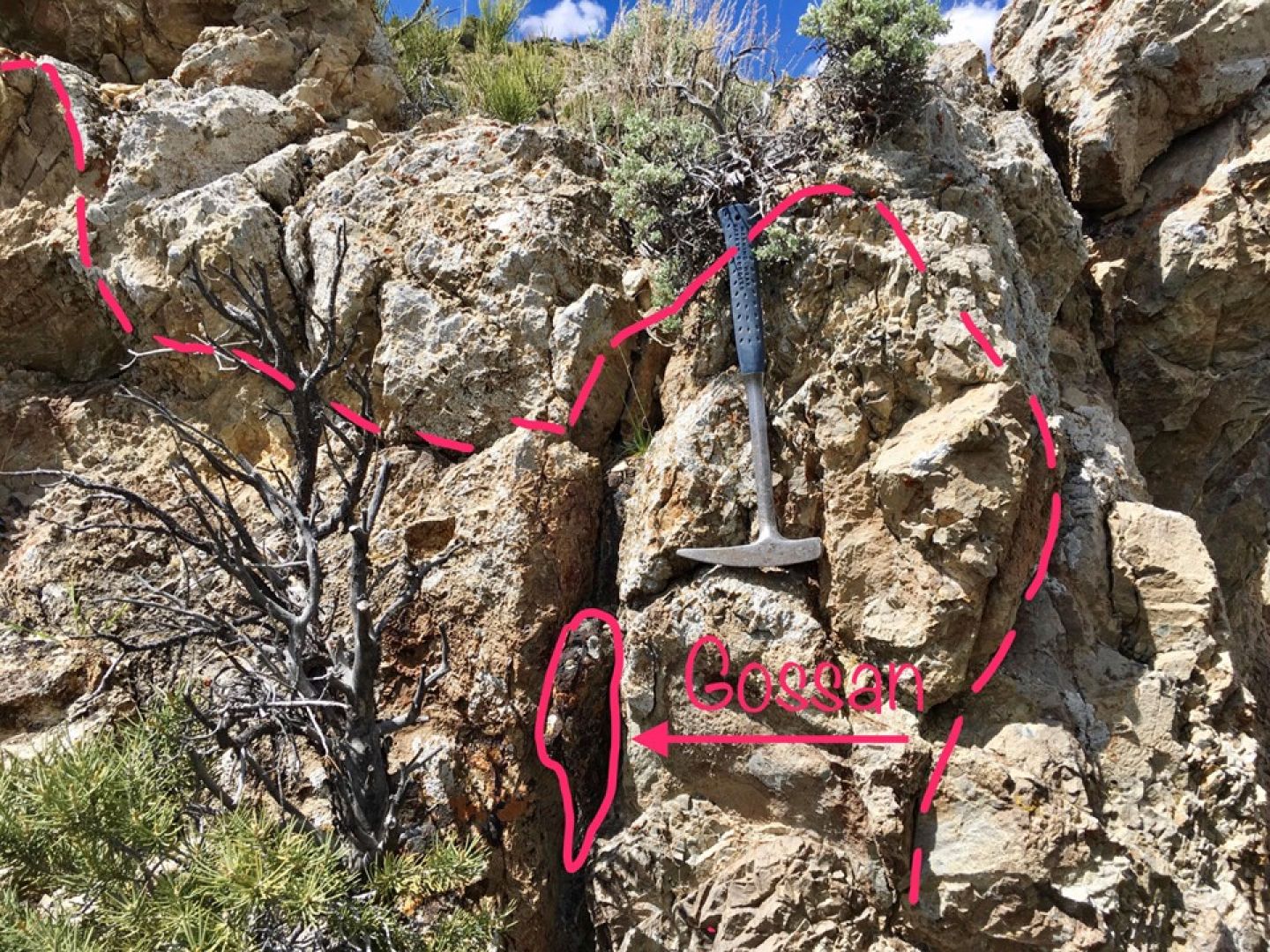
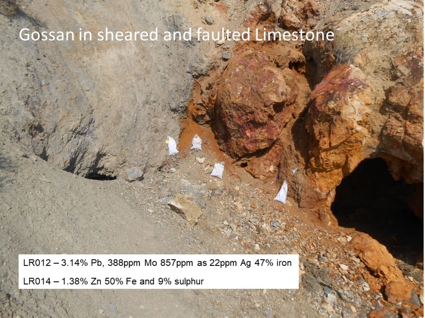
Since then, various Company prospecting campaigns have focused on a broader area containing numerous conspicuous iron-rich gossans derived from massive and semi-massive sulphides which also attracted the Company’s attention and that of early prospectors. These gossans have exotic geochemistry and consistently anomalous zinc, lead and silver with values up to 6.8% zinc, 3.3% lead and 51g/t silver. 43 samples taken from these gossans and old workings averaged 0.86% zinc.
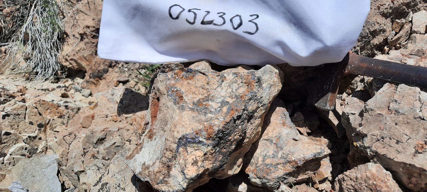
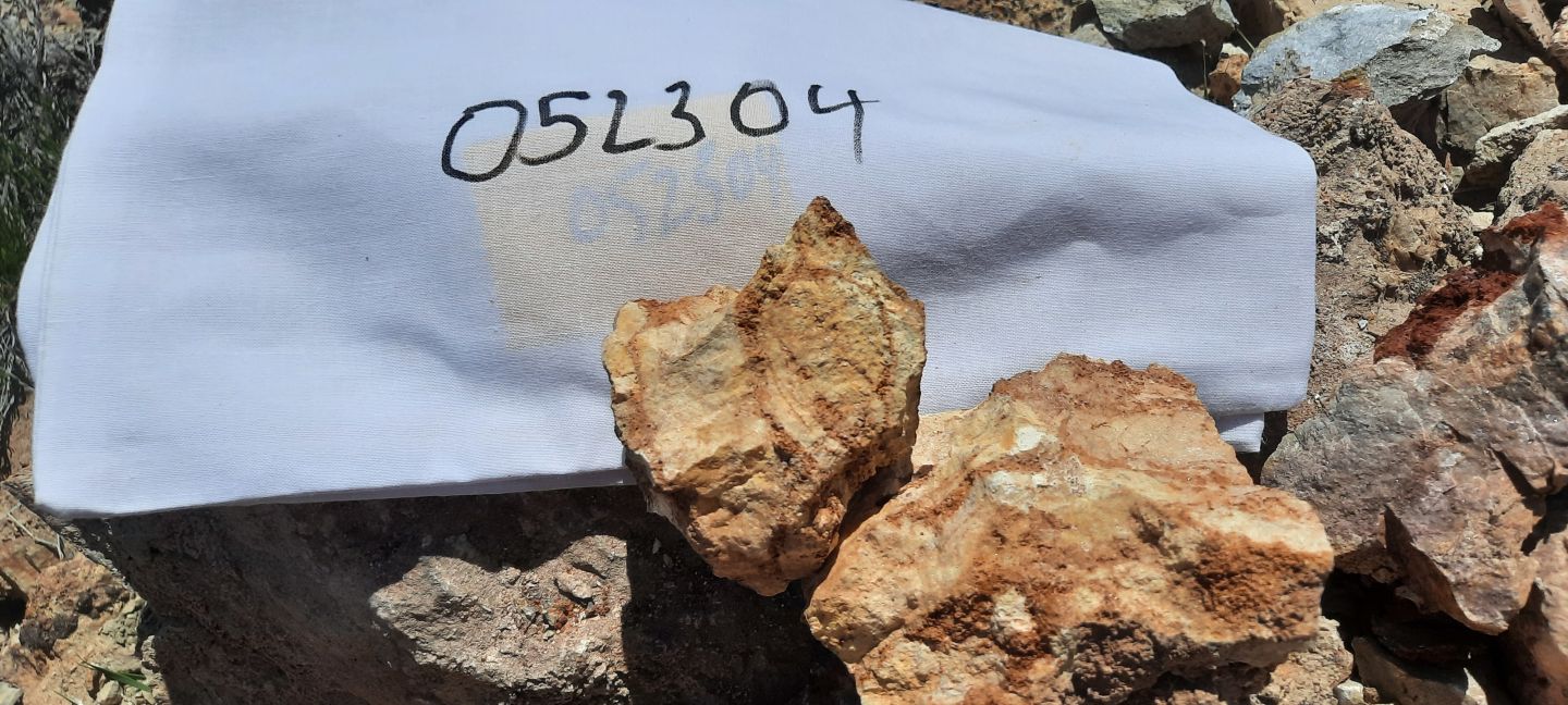
In May 2023 the original high-grade zinc sample site was revisited and two further samples collected and analysed with the following results:
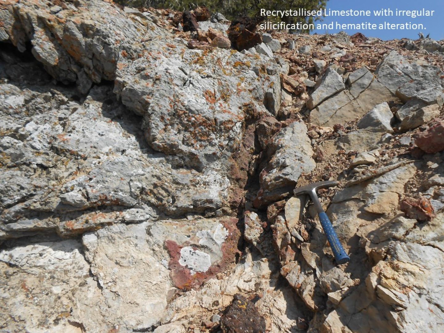
Sample 52303 contained visible galena and so the high lead content was to be expected. However, the very high zinc values in both samples were again a surprise as the samples were otherwise unremarkable. It is believed that the zinc in these samples is present as secondary zinc oxide, carbonate or silicate minerals. These minerals are difficult to identify in the field in an area where the rocks are significantly altered and do not have the stand-out character of iron rich gossans and are easily overlooked.
Whilst the widespread high visibility iron rich gossans at Reese Ridge are likely part of the same mineralising system, they were likely a red herring to the early prospectors and the Company’s own follow up sampling campaigns given that less visually distinctive samples are now confirmed to contain very high zinc levels.
In July 2024, the Company contracted geological consultants, Big Rock Exploration, to carry out a 3-day field reconnaissance programme using a pXRF analyser to gather real-time field information on the zinc, lead and silver levels across different parts of the project area. Extreme summer temperatures were experienced during the fieldwork (+40oC) which adversely affected the operation of the pXRF and the accuracy of readings. The pXRF did, however, help direct the collection of field samples for subsequent laboratory geochemical analysis.
This latest work has highlighted an area some 260m west of the previously identified high-grade samples where two rock samples yielded very high lead, zinc and silver results as follows:
- +24.5% combined lead-zinc and 383g/t silver in sample 24RR-AL19.
(4.5% zinc and greater than 20% lead, the upper instrument detection limit for the chosen analytical method)
- 18.6% combined zinc-lead and 51g/t silver in sample 24RR-AL18.
(11.7% zinc and 6.9% lead)
Sample 24RR-AL18 was taken from an old mine dump whereas sample 24RR-AL19 was taken from a rock outcrop. Outcrop in the project area is generally very poor due to the extensive scree deposits.
Widespread barite was also reported from scree by Big Rock Exploration.
The geological setting and geological features of the target are consistent with a Carbonate Replacement Deposit (CRD) style of mineralisation. These can be large and high grade. A relevant example is the Hermosa Project in the neighbouring State of Arizona which was acquired by South 32 in a US$1.3 billion takeover and which includes the Taylor Deposit (138 million tonne Mineral Resource with a zinc equivalent grade of 8.61%) now under development.
The project claims lie adjacent to the Reese River geothermal system which has been explored for geothermal energy. This exploration has included a number of geophysical techniques common to the mineral exploration industry, including VTEM and MT electromagnetic methods.
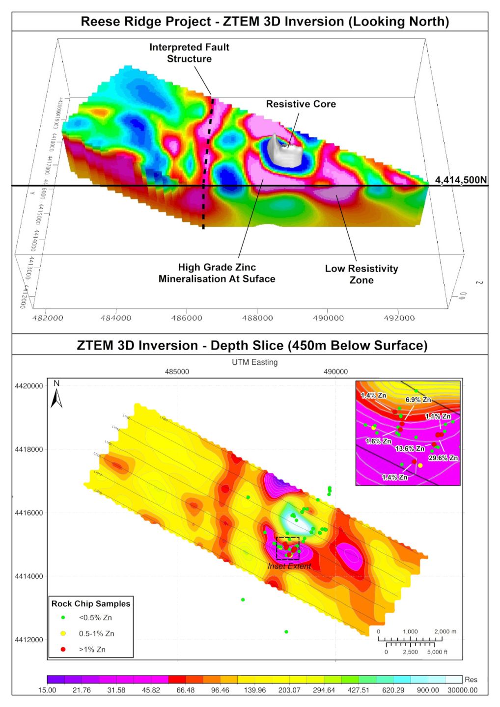
The area adjacent to the Reese River Project was explored for geothermal energy in 2010 and the Company has sourced ZTEM airborne electromagnetic data from this programme and commissioned leading Canadian geophysical company, Geotech Ltd (“Geotech”), to carry out further processing and 2D and 3D inversions on the ZTEM data.
3D inversion produces a 3D model that “maps” the conductivity of the earth at and below surface. The newly developed 3D model has confirmed an annular zone of low resistivity (high conductivity) below the surface mineralisation that extends from just below surface to a depth of nearly 1,000m. Such low resistivity zones can be cause by, for example, accumulations of conductive metal sulphide mineralisation. This annular zone surrounds a core of high resistivity which the Company interprets as a granitic intrusion. This would be consistent with a Carbonate Replacement Deposit (“CRD”) model for mineralisation.
The ZTEM anomaly and the associated surface mineralisation present a compelling drill target.