| Status | New Project Aquisition |
|---|
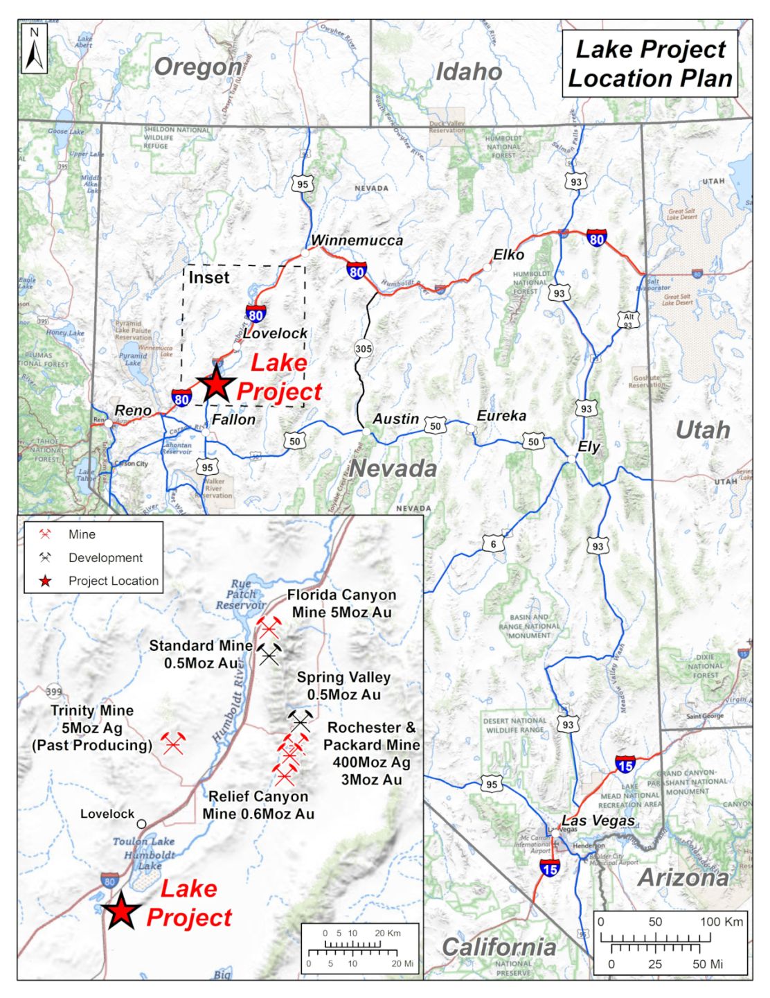
The Lake Project is located on the south side of the Mopung Hills which form the southwest end of the Humboldt Mountain Range in Churchill County, Nevada.
It is located 98km east-northeast of Reno and access is excellent from Interstate Highway I-80 and Highway 95 and a series unsealed roads and tracks to the project area.
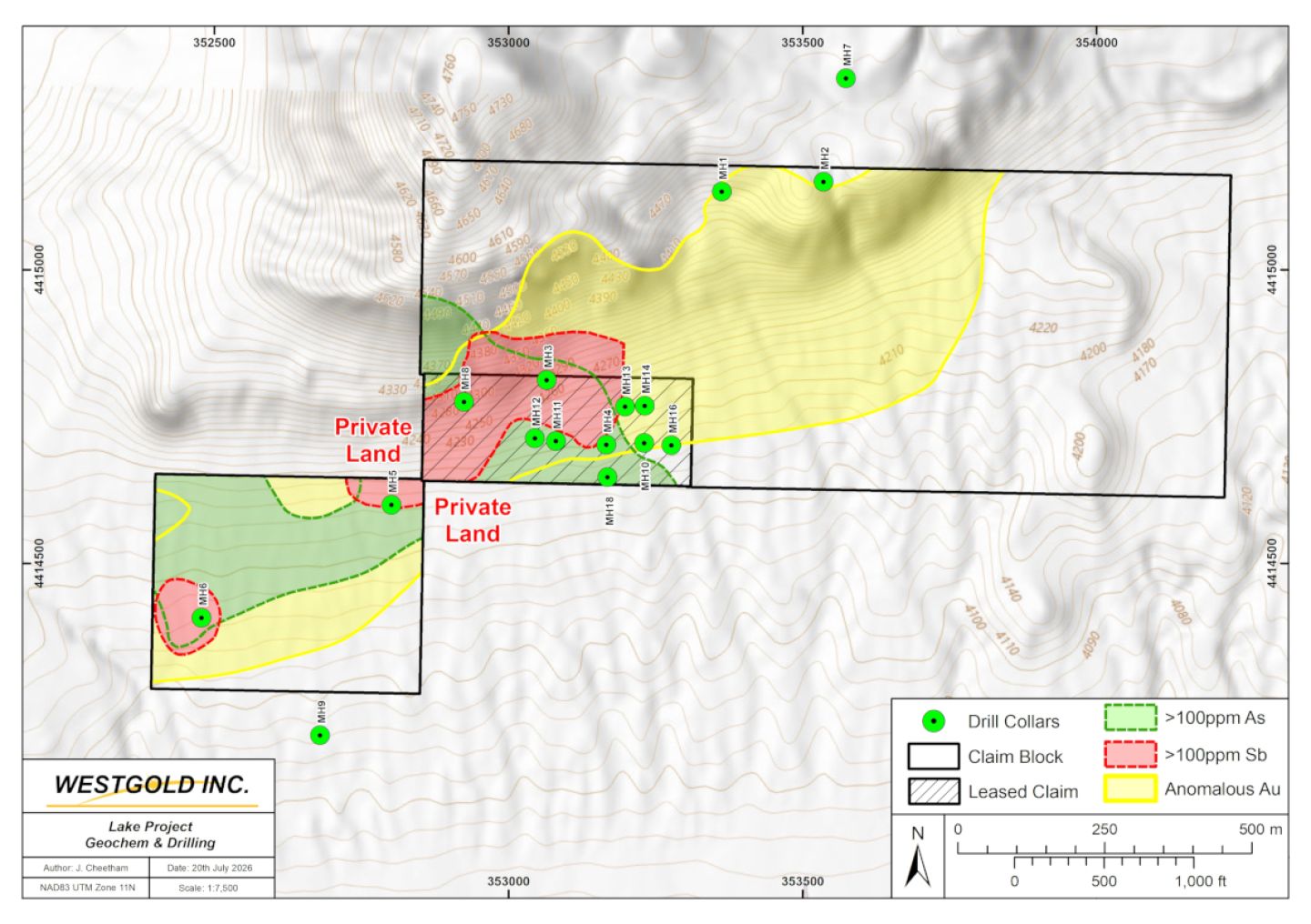
The only record of previous exploration in the target area is from the mid-1980s when Utah International (“Utah”), a US subsidiary of mining giant BHP, held a large claim block. Originally, Utah targeted the discovery of Carlin-type gold mineralisation. Exploration initially comprised detailed semi-regional mapping and rock chip sampling. Utah subsequently completed extensive claim staking and two separate phases of drilling. Fourteen shallow (mainly
Geology & Mineralisation
The youngest rocks in the area are a series of Tertiary-age volcanics that overlie Jurassic age gabbro and co-magmatic basalts, the gabbro being a part of the regionally extensive Humboldt Lopolith. The gabbro sits above a thrust fault contact with brecciated middle Jurassic age carbonates deposited in a shelf environment (black limestone, quartz arenites and calcarenites) and a lower Jurassic basinal sequence (thin bedded carbonaceous shaley limestone). Elsewhere in the Humboldt Range this thrust fault is referred to as the Wildhorse Thrust.
The south end of the Humboldt Range is a horst-block bounded by major northeast trending major fault zones. In the Company’s claim area a series of east-northeast trending high angle structural features mark a structural corridor parallel to the range bounding faults some several hundred metres wide where the shelf and basin carbonate sequences and Tertiary volcanics are hydrothermally silicified and decarbonatised and rock chip samples are anomalous in gold (0.1-0.55g/t) antimony (32 to 4,300ppm) and arsenic (25 to 750ppm), all classical indicators for Carlin-type gold deposits.
Utah postulated that reactive limestones beneath the Wildhorse Thrust could be host to Carlin-type gold deposits and this was the target for Utah’s first wide-spaced drill testing. This remains an attractive target at depth.
A number of Utah’s first phase of drill holes in the claim area intersected anomalous gold, arsenic and silver with gold values up 0.1g/t gold, as shown in the table below, but most notably hole MH-4 intersected a wide interval of mineralised skarn of economically significant grade:
MH-4: 50m grading 0.73% copper, 31g/t silver (1 oz/t) and 0.3g/t gold from surface.
A second phase of 7 shallow vertical drill holes made a number of further mineralised intersections with Hole MH-18 being of particular significance intersecting high values of silver and with skarn mineralisation continuing at the bottom of the hole.
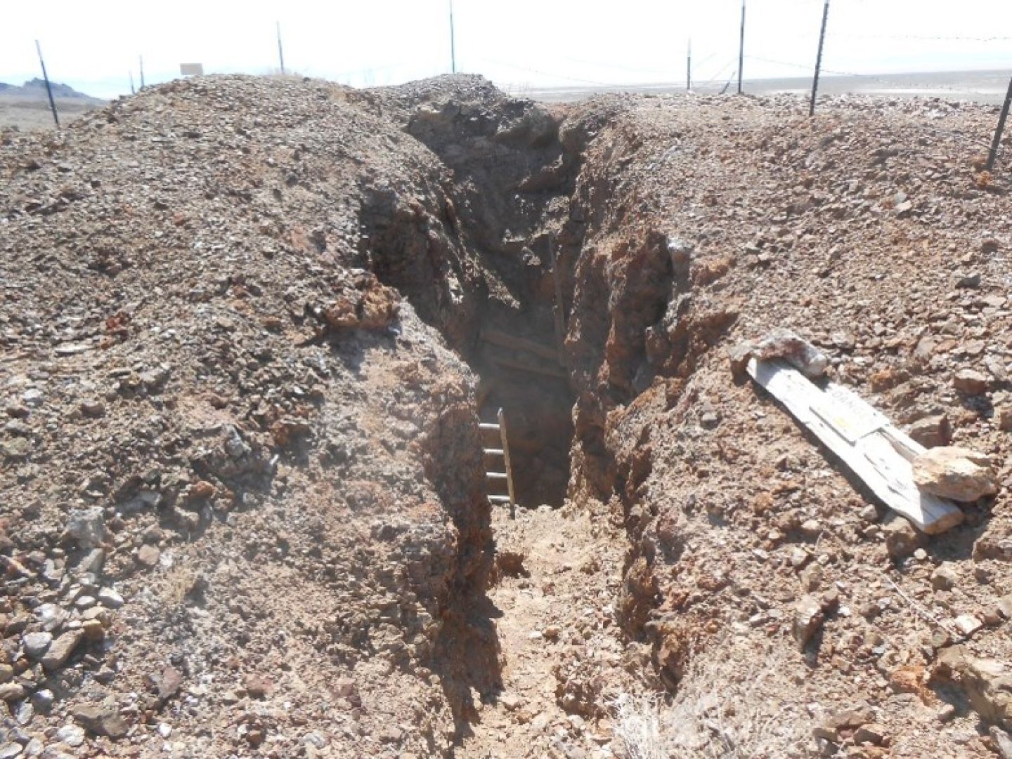
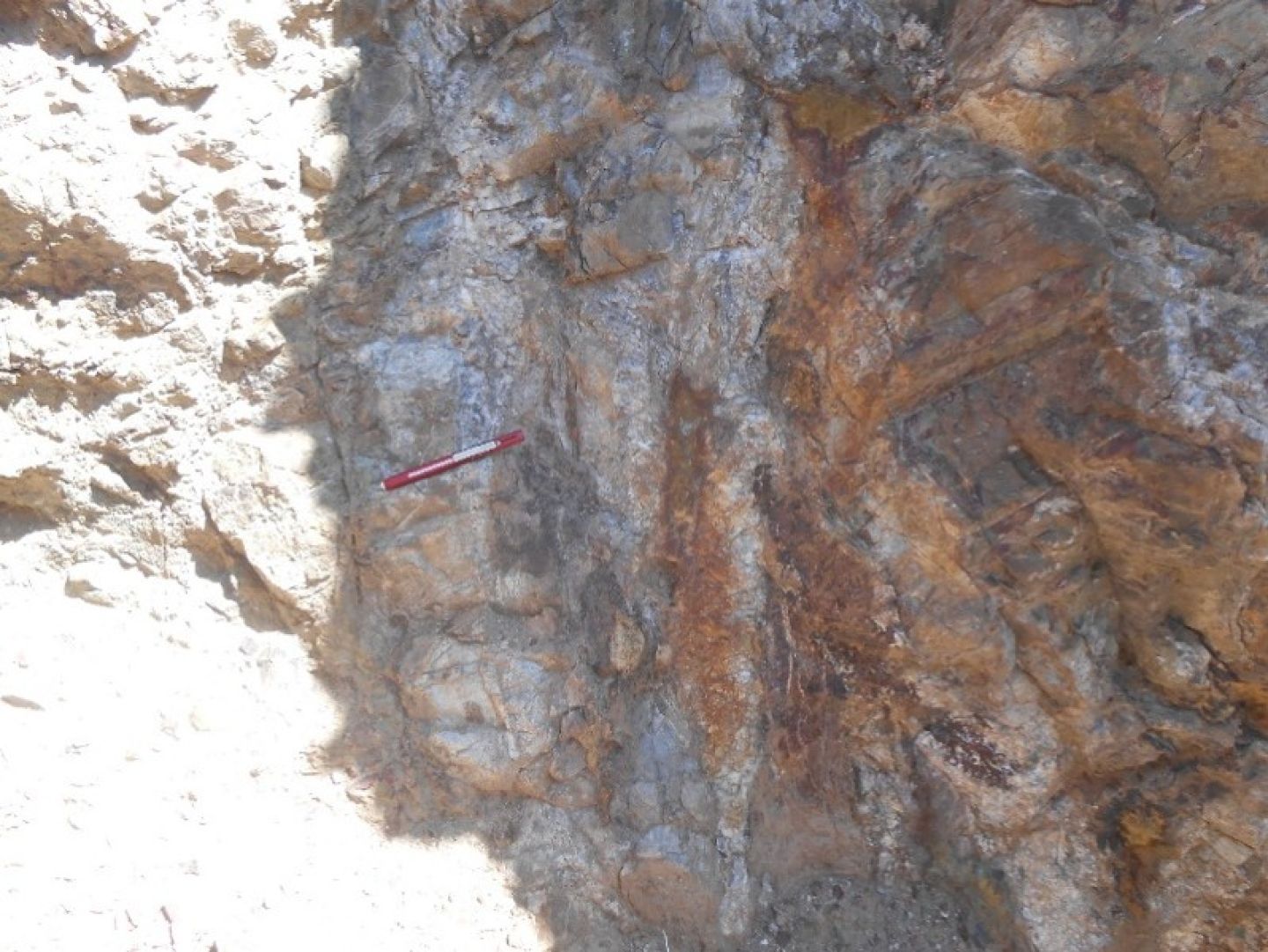
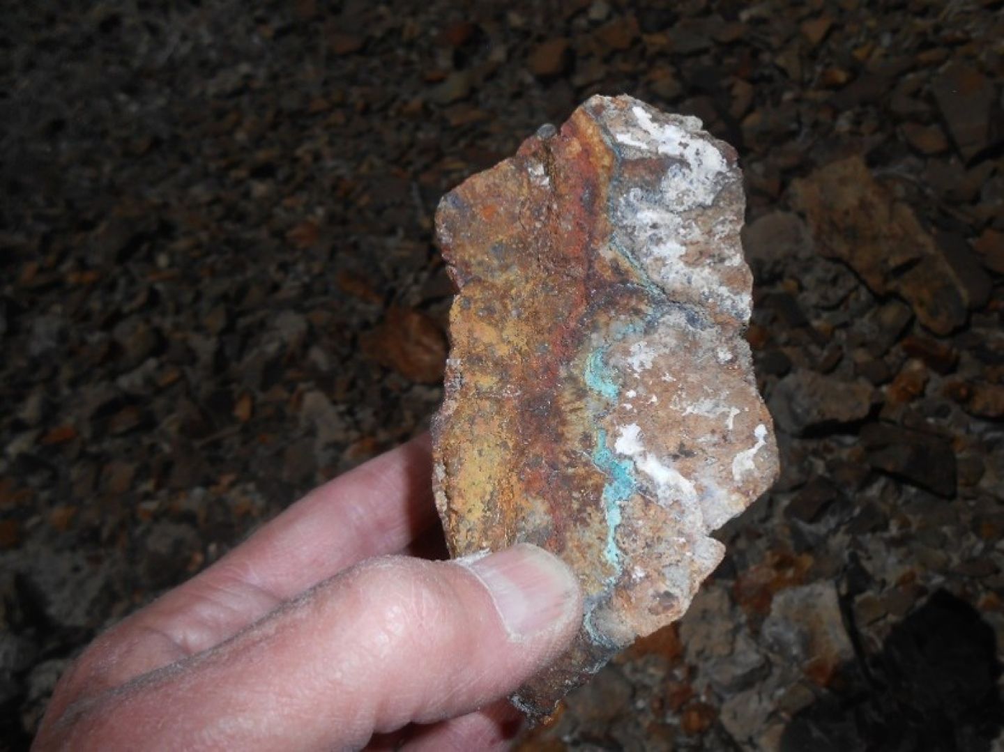
As part of its due diligence on the lease-option agreement, a field visit was made by the Company’s consulting geologist, Ivan Johnson. The mineralisation intersected from surface in Utah hole MH-4 was found to be visible in a small prospecting mine shaft where sub-vertical ribs of massive silica in upper plate calc-arenites border quartz-garnet skarn with visible copper stain and up to 20% pyrite.
A surface sample from the wall of this prospecting shaft assayed 198g/t silver, 0.13% copper and 0.3g/t gold.
The geology of the project area is complex with multiple phases of faulting and mineralisation having taken place over a long period of geological time. The Company is primarily targeting an intrusive related copper-precious metals deposit although Carlin-type and epithermal mineralisation are also valid targets. Drilling to date has been shallow but has nevertheless made drill intersections of economic significance. The copper-silver silicified skarn mineralisation is sulphide-rich from surface and so potentially amenable to geophysical targeting prior to drilling.
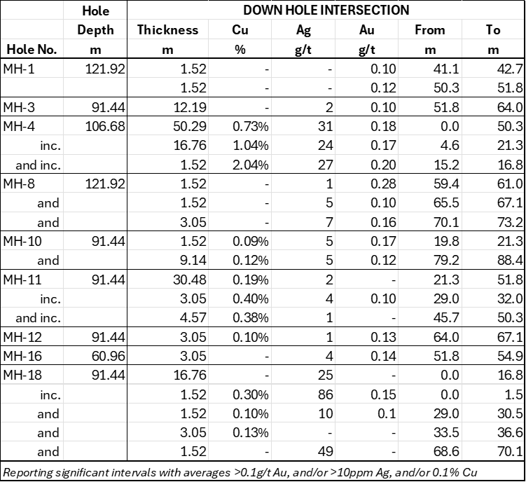
Table of significant drill intersections, Utah International 1985